請用 Wechat 掃描台灣精品QRcode 或 搜尋ID: TaiwanExcellence
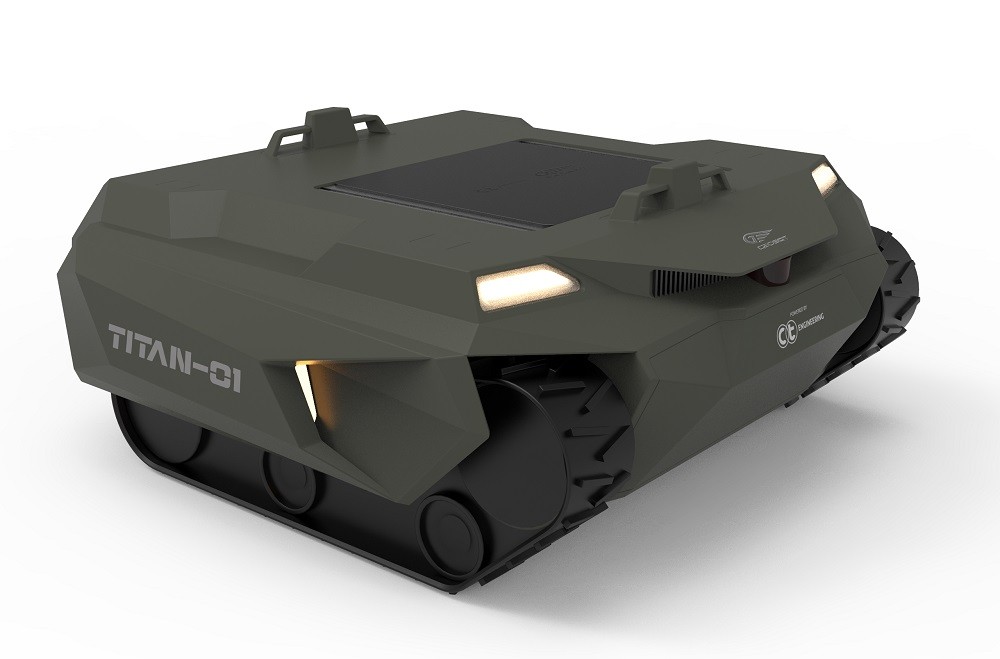
"TITAN" tracked unmanned intelligent vehicle is a new product jointly developed by GEOSAT Aerospace and CT Engineering for the defence field. Combining the self-guided and obstacle avoidance technology of GEOSAT Aerospace and CT Engineering's chassis design capabilities makes these automated smart vehicles a reality.
The TITAN unmanned vehicle adopts tracked transmission, which can easily overcome complex terrains and complete tasks with highly-efficient movement.
The vehicle can plan its maneuver path in advance and the onboard mission computer automatically navigates.
It switches between different mission scenarios through a modular design, such as ammunition delivery, battlefield scouting, drone platform, medical evacuation and more. It fully meets the changing mission requirements to enhance troops' combat efficiency.
About GEOSAT Aerospace & Technology Inc.
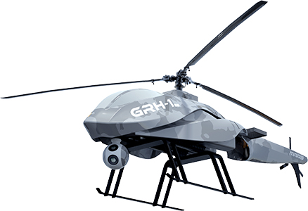
GEOSAT Aerospace & Technology Inc. was founded in 2004. We are the only company in Taiwan to vertically integrate upstream (Research & Development), midstream (Operation Services), and downstream (Data Analysis) activities into our UAV services, providing total solution for our clients. Our project experiences in emergency relief service, disaster and flood prevention, water conservation, land use survey, resource exploration, base map mapping. Our achievements is recognized in 2014 by the Ministry of Economic Affairs to honor “National Industry Innovation Award”. We have many professionals with background from aerospace, geomatics, urban development, and spatial information to build competence in system integration, aerial photogrammetry and image processing.
GEOSAT Aerospace and technology Co. was established at 2004. Our company is a professional system integration and spatial information service company. Based on advanced aerospace engineering technology, utilized onto spatial informatics and applications. Focused on developing Unmanned Aerial Vehicles (UAV) and their respective technology and systems. In 2007, in order to elevate the quality of our nation’s measuring capabilities, receive the right to be part of the mapping industry. In 2015, we started innovative services such as providing ortho image footage of the Gas explosion stricken area of 6 square kilometer within 24 hours for post-hazard strain decision making and rescue applications; as well as providing footage with resolution of 3 cm, while using auto-identification system to proceed investigation of location and coverage of 15 tree species. Our courage to innovate has pushed us to improve and obtain the Oscar of industry innovation “national industry innovation prize”.
Contact info
Tel:02-27084438#3207
Fax:02-27088246
Email:cvn682001@geosat.com.tw
Tel:02-27084438#3207
Fax:02-27039168
Email:cvn682001@geosat.com.tw
Email:jade@geosat.com.tw
Tel:06-335-1068#300
Fax:06-290-9405
Email:JoyHsiao@geosat.com.tw
Tel:02-27084438#1014
Fax:02-27088246
Email:edwardhsieh@geosat.com.tw