請用 Wechat 掃描台灣精品QRcode 或 搜尋ID: TaiwanExcellence
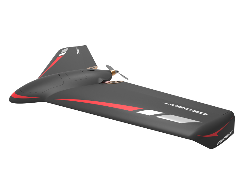
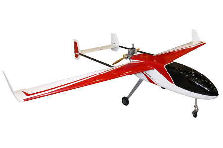
Pterosaur is a fixed-wing system.It is light and easy to operate. It use throw or ejector rack at a fixed point to takeoff , to response a variety of critical mission environment, such as slope, sand and other terrain restrictions.It also use safe landing parachute for landing, able to reduce the body itself and the important payload equipment damage,so that the task of the mission can be operate at any time.
With excellent flight performance, the longest endurance flight time can reach up to 70 minutes, each sorty can take a range of up to 1,800 hectares. Using 2.4 megapixel digital camera, able to collect up to 3 cm of image resolution.
According to the past of flight mapping tasks, ground control system mission planning, the use of man-machine interface design, easy to set. Flight control system with high-performance autonomous navigation, automatic flight control, task management of the integrated system, using a large number of complex data processing and mathematical operations
About GEOSAT Aerospace & Technology Inc.
GEOSAT Aerospace & Technology Inc. was founded in 2004. We are the only company in Taiwan to vertically integrate upstream (Research & Development), midstream (Operation Services), and downstream (Data Analysis) activities into our UAV services, providing total solution for our clients. Our project experiences in emergency relief service, disaster and flood prevention, water conservation, land use survey, resource exploration, base map mapping. Our achievements is recognized in 2014 by the Ministry of Economic Affairs to honor “National Industry Innovation Award”. We have many professionals with background from aerospace, geomatics, urban development, and spatial information to build competence in system integration, aerial photogrammetry and image processing.
GEOSAT Aerospace and technology Co. was established at 2004. Our company is a professional system integration and spatial information service company. Based on advanced aerospace engineering technology, utilized onto spatial informatics and applications. Focused on developing Unmanned Aerial Vehicles (UAV) and their respective technology and systems. In 2007, in order to elevate the quality of our nation’s measuring capabilities, receive the right to be part of the mapping industry. In 2015, we started innovative services such as providing ortho image footage of the Gas explosion stricken area of 6 square kilometer within 24 hours for post-hazard strain decision making and rescue applications; as well as providing footage with resolution of 3 cm, while using auto-identification system to proceed investigation of location and coverage of 15 tree species. Our courage to innovate has pushed us to improve and obtain the Oscar of industry innovation “national industry innovation prize”.
Contact info
Tel:02-27084438#3207
Fax:02-27088246
Email:cvn682001@geosat.com.tw
Tel:02-27084438#3207
Fax:02-27039168
Email:cvn682001@geosat.com.tw
Email:jade@geosat.com.tw
Tel:06-335-1068#300
Fax:06-290-9405
Email:JoyHsiao@geosat.com.tw
Tel:02-27084438#1014
Fax:02-27088246
Email:edwardhsieh@geosat.com.tw